


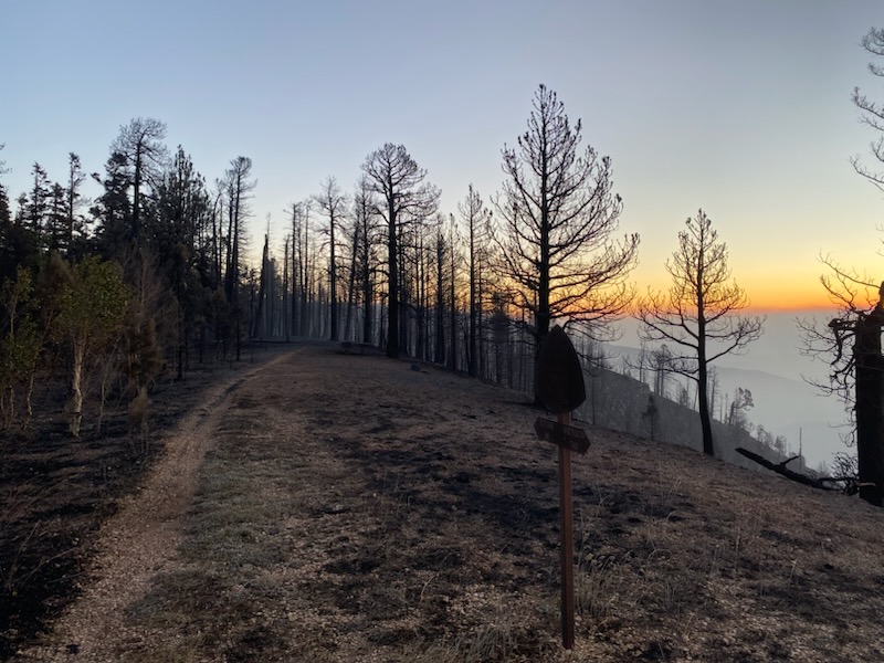
On October 1, the Kaibab National Forest reopened 11 miles of the Arizona National Scenic Trail between the Kaibab Plateau Trailhead at the Park/Forest boundary and Forest Road 213 near Telephone Hill Trailhead. Passage 40 is now completely open! However, 29 miles of the AZT between The Tipoff (4.6 miles north of the South Kaibab Trailhead) and the Park/Forest boundary along Passages 38 and 39 remain closed. Since the Dragon Bravo Fire had significant impacts to the trail and surrounding landscape, visitors should be aware of hazards associated with traveling within a burn zone. This includes: Watch for falling trees. Even if the tree looks robust, it might be at risk of falling because of damaged root systems and fire-loosened soils. Watch for falling branches. Look up often and be aware of fire-weakened trees, snags and overhead dangling branches. Do not sit down and take a break under a fire-weakened or dead tree. Windy days are especially dangerous. Don’t go out in a burn area if it’s forecast to be windy. Leave the area immediately if the wind picks up and there are hazards around you. Don’t make camp below burned trees. Rainy weather can be very dangerous. Rain increases the likelihood of landslides and flash floods....
Read More
Location
- Kaibab National Forest boundary to Telephone Hill Trailhead
Length
- 20.7 miles
Resources
- MAP
- PROFILE
- TRACK
- Waypoints: GPS | MP
- Arizona Euro-American History
- USGS Topographic Maps: Little Park Lake, Dog Point and Telephone Hill.
- Kaibab National Forest map.
- BLM Information Center maps.
Southern Access Point: Kaibab National Forest boundary
- GPS Coordinates: 36.33775° N, 112.10248° W
Access
From Jacob Lake, drive south on AZ 67 for 26 miles and turn left (east) onto FR 611 (4.5 miles north of the Grand Canyon National Park entrance station and 1 mile south of Kaibab Lodge). Drive 1.1 miles and turn right (east) onto FR 610. Wind south and then east 5.1 miles to a pullout on the north side of the road, near a brown AZT post.
Northern Access Point: Telephone Hill Trailhead
- GPS Coordinates: 36.55147° N, 112.17560° W
Access
About 13.5 miles south of Jacob Lake on AZ 67, look for a sign pointing to FR 429 on the west side. Do not turn right onto FR 429, but instead turn left (east) onto FR 241. In 0.1 miles, the AZT crosses the road, but there is no parking here. Continue another 0.1 miles to a little campsite on the left, where you may be able to park.
Trail Route Description

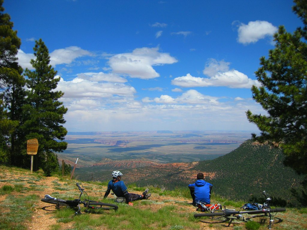
Passage 40 begins at the Kaibab National Forest boundary and traverses through an idyllic forest of spruce, pine and aspen. Located in a much-overlooked area of northern Arizona, this section offers easy and pleasant travel along singletrack through gently rolling terrain.
As the trail winds along the East Rim of the Grand Canyon, it dips into tranquil meadows and passes by the East Rim Viewpoint. It features scenic views and the peaceful valley of Tater Canyon.
The East Rim Viewpoint is a highlight of this section with breathtaking views of Saddle Mountain Wilderness, Marble Canyon, Vermillion Cliffs, and Navajo Mountain in the distance.
Difficulty
- Easy to Moderate
Season(s)
- Spring, Summer and Fall
- Current weather forecast
Water
There are seasonal an probable water sources on this part of the Kaibab Plateau. Check the online Arizona Trail Water Report for current information at https://aztrail.org/explore/water-sources/.
Notes/Warnings
- All water along this passage should be purified prior to use.
- The Arizona Trail is marked with brown fiberglass posts with a Kaibab Plateau Trail decal near the top.
- When the AZT is buried under snow in the springtime, hikers are allowed to walk on Hwy 67 before the road opens, typically on May 15. Mountain bikers are not allowed to ride the road and must follow the trail. Hikers walking the plowed and paved road should be aware of vehicles and snowplows; this means no camping, campfires, or full spread meals in the middle of the road.
For more information
- The Passage Steward
- Kaibab National Forest, North Kaibab Ranger District, P.O. Box 248, Fredonia, AZ 86022 (928) 643-7298.
- Kaibab Plateau Visitor Center, Jacob Lake, AZ (928) 643-7298.
- BLM Information Center (602) 417-9300.
Current Passage Info
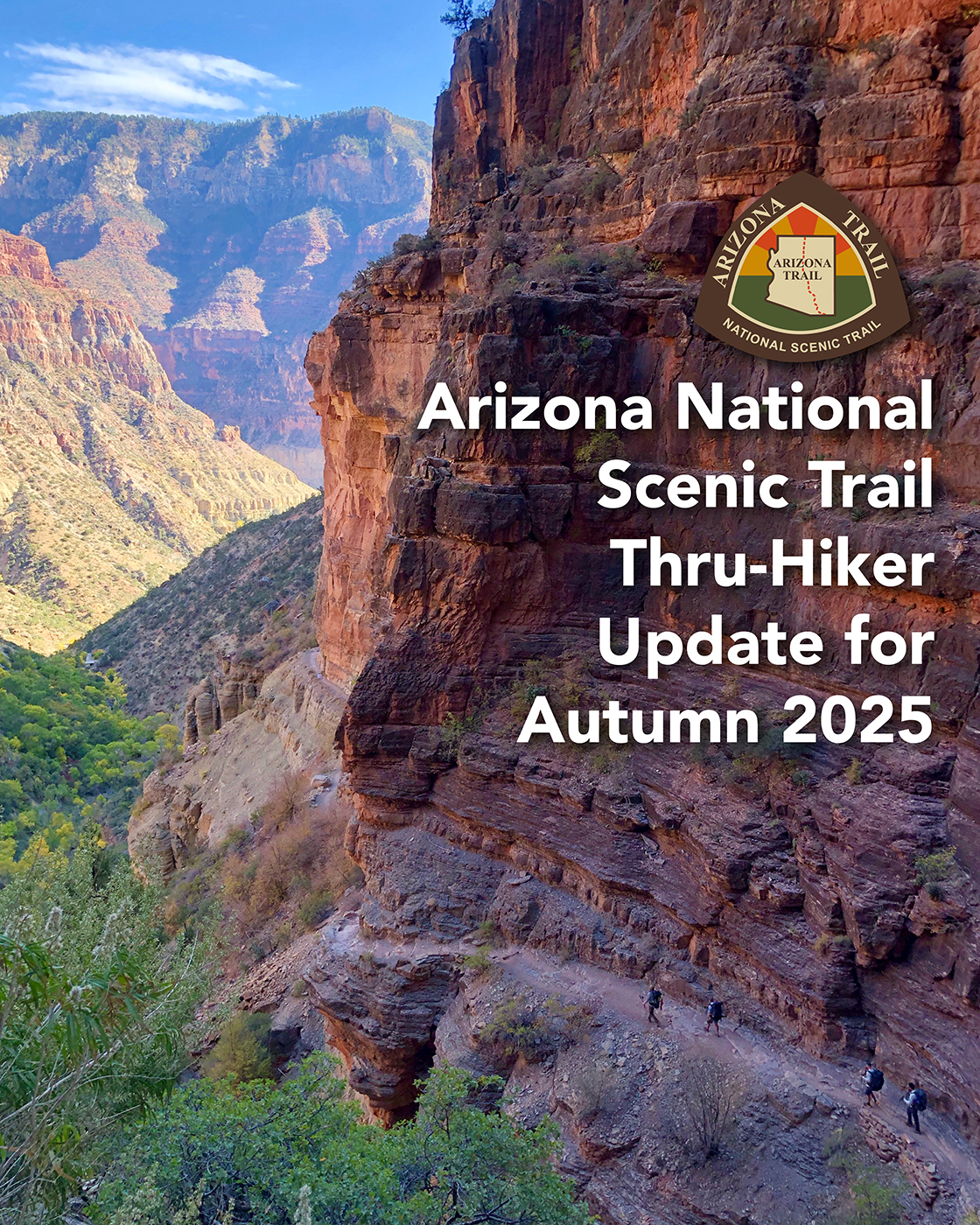
Arizona National Scenic Trail Thru-Hiker Update for Autumn 2025
September 10, 2025
Arizona National Scenic Trail Thru-Hiker Update for Autumn 2025 After a dry winter and a parched spring, we all knew this could be the worst wildfire year in recent history. But we held out hope for a bountiful summer monsoon season. Instead, we keep seeing heat records being broken and rainstorms yielding just a few intermittent drops. Living in the Southwest during a prolonged drought is challenging, and despite our efforts to maintain and improve the trail; enhance water sources; and make the Arizona Trail the premier long-distance trail in America, attempting to walk or ride 800 miles gets more intense every year. The White Sage and Dragon Bravo fires have impacted almost 100 miles of the Arizona Trail this season. Through recent reports from agency staff assessing the damage on the ground and from the air show us that approximately 35 miles were directly impacted. Some good news is that only 2% was a high intensity burn; 26% was moderate; and 65% was low intensity. The Arizona Trail Association is working with the US Forest Service to reroute the AZT around the most severely burned areas on the Kaibab National Forest, utilizing trails and dirt roads to provide a...
Read More

Handmade AZT Mugs
May 28, 2019
We are delighted to offer the third in a series of commemorative mugs celebrating the natural beauty of the Arizona National Scenic Trail! This handmade mug features a scene from the Kaibab Plateau Passage of the AZT near the North Rim of Grand Canyon, including lush meadows, dense fir forests, and an American bison. This was the first segment of Arizona Trail officially designated, and remains one of the highlights along the 800-mile trail (it feels more like Canada than Arizona). These mugs are a membership benefit to anyone joining or renewing your membership at the Ironwood level ($100/year) and above. Support the ATA and enjoy your favorite beverage while dreaming of adventures in northern Arizona this summer.
Read More
