


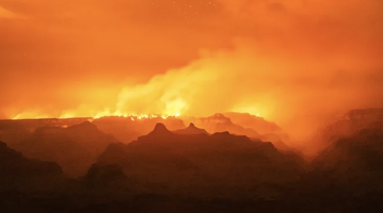
The White Sage Fire and Dragon Bravo Fire have forced 90 miles of the Arizona Trail to close from the South Kaibab Trailhead on the South Rim of Grand Canyon to Orderville Trailhead at Hwy 89A. Both fires started from lightning strikes in July and are being managed by the Kaibab National Forest, Grand Canyon National Park, and Bureau of Land Management. Highway 67 is closed between Jacob Lake and Grand Canyon National Park, as well as all trails, dirt roads, and campgrounds in the area. Please avoid the AZT on the Kaibab Plateau until further notice, and check back for updates.
Read More
Location
- South Kaibab Trailhead to North Kaibab Trailhead
Length
- 21.4 miles
Resources
- MAP
- PROFILE
- TRACK
- Waypoints: GPS | MP
- Arizona Euro-American History
- A Guide to the Arizona Trail at Grand Canyon website
- USGS Topographic Maps: Phantom Ranch and Bright Angel Point
- Grand Canyon National Park map
- BLM Information Center maps
Southern Trailhead: South Kaibab Trailhead
- GPS Coordinates: 36.05335° N, 112.08344° W
Access
There is no overnight parking or camping at the trailhead. You must take a shuttle from Grand Canyon Village, near the intersection of US 180 and AZ 64. Information is available within the Park Guide you’ll receive at the entrance kiosk, and also at the Visitor Center.
Northern Trailhead: North Kaibab Trailhead
- GPS Coordinates: 36.21699° N, 112.05666° W
Access
The parking area is on the east side of AZ 67, 41 miles south of Jacob Lake and 2.3 miles north of Grand Canyon Lodge. The trailhead is at the south end of the parking lot.
Trail Route Description
Passage 38 crosses the Grand Canyon from the south rim to the north rim. This physically strenuous and awe-inspiring section follows the well-maintained South Kaibab Trail that descends sharply from the south rim to the Colorado River, then ascends steeply to the north rim on the North Kaibab Trail. Your hard work will be rewarded by the sheer beauty of the Grand Canyon and what is possibly the most scenic section of the Arizona National Scenic Trail!
This section completes the epic “rim-to-rim” route and is both spectacular and challenging. In fact, many people see the route through this section as a bucket list experience on its own.
Prepare yourself for extreme changes in elevation and climate, a variety of ecosystems, and a journey through two billion years of geological history that is unlike anywhere else in the world!
The journey begins on the South Kaibab Trail, a high-quality trail with scenic vistas, little shade, and no water. The trail makes a stunning descent of over 4,000 feet within the first six miles, following a series of switchbacks down the canyon wall to meet the mighty Colorado River.
After passing by Phantom Ranch at the bottom of the canyon, the trail becomes the North Kaibab Trail, where it continues gently toward Cottonwood Campground. After this landmark, North Kaibab truly begins its arduous climb out of one of the world’s deepest canyons. It ends at the North Kaibab Trailhead at an elevation of 8,000 feet, where temperatures remain cold and snow may persist into late spring.
There are no words or photographs that can convey the magnitude of the Grand Canyon’s unique landscape. The only way to appreciate the canyon’s grandeur is to hike into its depths, a place that gets fewer than one percent of the park’s total annual visitors. A short side trail leads to Ribbon Falls, one of the most photographed features within the canyon’s inner gorge. Don’t miss it! To learn more about the cultural significance of Ribbon Falls to Zuni people, watch this short video (courtesy of Grand Canyon Association and Grand Canyon Trust).
Grand Canyon National Park requires a camping permit, and camping is only allowed in developed campgrounds (along the AZT, that’s Bright Angel and Cottonwood). Although Grand Canyon backcountry permits can be very challenging to obtain, you can apply through recreation.gov. The Park has set aside two small sites for AZT thru-hikers (each site is 1-6 people, so for the two sites a total of 12 hikers per night are available) at Bright Angel Campground from April 4 – May 31. Hikers are also welcome to try to get a last-minute walk-up permit from the Backcountry Office on the South Rim or North Rim. For those last-minute permits, you may still have to wait a day or two to get through. Attempting to camp in Grand Canyon without a permit is not recommended and will guarantee you a big ticket…this is, after all, one of the most heavily patrolled parks in the National Park system. And while hiking through the entire canyon in a day is possible, a magical part of the AZT experience is camping within the canyon — one of the seven natural wonders of the world. So do your best to score a permit and camp in Bright Angel and/or Cottonwood.
For the ultimate guide to the Arizona Trail to the Grand Canyon, please check out this comprehensive website developed by trail steward extraordinaire and Grand Canyon expert Forrest Radarian.
Difficulty
- Difficult
Season(s)
All year. Snow may be present after winter storms
Water
Water can be found at the Colorado River, Bright Angel Campground, Phantom Ranch, Bright Angel Creek, Cottonwood Camp and Roaring Springs. Check the online Arizona Trail Water Report for current information at https://aztrail.org/explore/water-sources/.
Notes/Warnings
- All water found in creeks and springs should be purified prior to use.
- Mountain bikes are prohibited from being ridden in the canyon. You may carry your bike on your back but the wheels must never touch the ground. You can also send your bike to the other side of the canyon on the TransCanyon Shuttle while you hike across.
- Horses are not recommended in the canyon. Please contact the Backcountry Office for more information.
- A reservation and permit are required to spend a night below the rim. Day hiking does not require a permit. For more details on this, go to the Permits page.
- North Rim facilities are closed from mid-October to mid-May.
For more information
- The Passage Steward
- Grand Canyon National Park, P.O. Box 129, Grand Canyon, AZ 86023 (928) 638-7888
- Backcountry Information Center, Grand Canyon National Park, P.O. Box 129, Grand Canyon, AZ 86023 (928) 638-7875
- BLM Information Center (602) 417-9300
Current Passage Info

Grand Canyon’s Bright Angel Campground Closed from November 4, 2024 – May 15, 2025
July 11, 2024
Grand Canyon National Park announced in July that Bright Angel Campground will be closed from November 4, 2024 - May 15, 2025 to support replacement of the TransCanyon Pipeline. This will impact Arizona Trail thru-hikers during the Spring 2025 season. Since dispersed camping is not permitted in this area and inner canyon corridor trails are patrolled daily, thru-hikers should attempt to obtain an overnight camping permit for Cottonwood Campground (halfway between Bright Angel Campground and the North Rim) or hike from rim-to-rim in a single day. Please contact the Backcountry Information Center at Grand Canyon National Park for more details: (928) 638-7875.
Read More
