


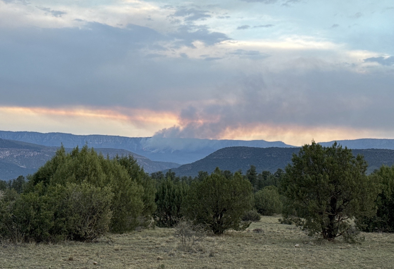
The Washington Fire is burning between the Arizona Trail and the Mogollon Rim, just west of Washington Park near AZT mile 478. The fire has grown to 381 acres and is currently being managed by the Coconino National Forest. A total of 8.6 miles of the AZT is now closed between FR 300 (Rim Road) and East Clear Creek along Passage 27 (Blue Ridge). Evacuations have been issued for Washington Park and Mountain Meadows Ranch. Please avoid the area until the fire is contained. For up-to-date information on the Washington Fire, and other fires, we recommend using the Watch Duty app.
Read More
Location
- Mogollon Rim to Highway 87
Length
- 15.4 miles
Resources
- MAP
- PROFILE
- TRACK
- Waypoints: GPS | MP
- Arizona Euro-American History
- USGS Topographic Maps: Kehl Ridge, Dane Canyon and Blue Ridge Reservoir.
- Coconino National Forest – Visitors Guide.
- Coconino National Forest – Recreational Opportunity Guide.
- Coconino National Forest map.
- BLM Information Center maps.
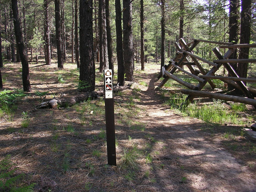
Southern Trailhead: FR 300 Trailhead
- GPS Coordinates: 34.45396° N, 111.25078° W
Access
From the intersection of AZ 87 and AZ 260 north of Pine, drive east 2.6 miles on AZ 87 then turn right (south) toward FR 300. Go 0.1 miles and turn left onto FR 300. Avoid the frequent side roads and drive 12 miles on FR 300 to a turnoff on the left (north) at a historical marker for the Battle of Big Dry Wash. This is where the AZT crosses FR 300. Turn left and follow a power line 0.3 mile to General Springs Cabin. The road curves right to a small parking area and the trailhead.
Northern Access Point: Highway 87
- GPS Coordinates: 34.60751° N, 111.20061° W
Access
From the intersection of AZ 87 and AZ 260 north of Pine, drive northeast 19.5 miles on AZ 87 then turn right (south) on FR 138. (This is about 0.8 miles west of the Blue Ridge Ranger Station on AZ 87.) Signs on the highway point to Moqui Campground. The trailhead is about 100 yards south on FR 138, on the left (east) side of the road.
Trail Route Description
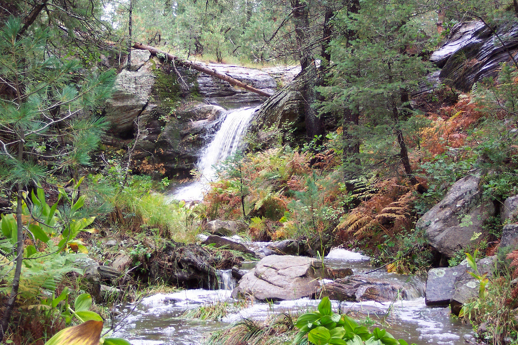
Passage 27 traverses north on top of the Mogollon Rim. The trail through this section follows a mix of single and doubletrack across meadows, forests, and canyons. It features aromatic pine trees, flowing water, and the historic General Springs Cabin.
The trail crosses pristine natural beauty such as the quiet sanctuary of General Springs Canyon. It passes through thick stands of pine and fir trees and drops into East Clear Creek. Although roads bisect much of the passage, none are heavily traveled, and their presence does not spoil this quiet corner of the Mogollon Rim.
This passage is mostly flat, with two notable exceptions. The first is the 500-foot-deep gorge carved by East Clear Creek, which flows into Blue Ridge Reservoir. The second is the steep drop from Blue Ridge to Highway 87. Neither is particularly difficult, and this passage as a whole is relatively easy.
Difficulty
- Moderate
Season(s)
- Spring, Summer and Fall
- Current weather forecast
Water
Water may seasonally be found at Blue Ridge Campground when open May – October and in stock tanks in the vicinity of the trail. There is also seasonal water in some of the drainages the trail crosses. Check the online Arizona Trail Water Report for current information at https://aztrail.org/explore/water-sources/.
Notes/Warnings
- All water along this passage should be purified prior to use.
- When Blue Ridge Reservoir is full, by turning right in the East Clear Creek drainage area, the water can be reached within 1/4 mile. When the reservoir is low, water may be several miles away.
- An interesting side trail leads off of FR 123E to a monument that was erected at a battle location. It lists the names of the Indian warriors and U.S. Cavalry members who fought in the Battle of Big Dry Wash. For more information, download the January 1931 Arizona Historical Review from http://hdl.handle.net/10150/623320 and see “The Battle of Big Dry Wash” by Will C. Barnes, page 36.
For more information
- The Passage Steward
- Coconino National Forest, Mogollon Rim Ranger District, 8738 Ranger Road, Happy Jack, AZ 86024 (928) 477-2255.
- BLM Information Center (602) 417-9300.
