


Location
- Sunflower to Mount Peeley
Length
- 16.6 miles
Resources
- MAP
- PROFILE
- TRACK
- Waypoints: GPS | MP
- Arizona Euro-American History
- USGS Topographic Maps: Boulder Mountain, Reno Pass, Lion Mountain and Mazatzal Peak.
- Tonto National Forest map.
- BLM Information Center maps.
Southern Access Point: Sunflower
- GPS Coordinates: 33.86250° N, 111.47278° W
Access
From Phoenix, take AZ 87 north to FR 22 (Bushnell Tanks Road). Turn right and park at the gate about 150 yards off the highway. This road is currently closed to vehicle traffic by Tonto National Forest. You can walk down the road about 0.5 miles and turn right at the sign and drop into Sycamore Creek flood plain. Walk up stream following the cairns and across two drainages, follow the next drainage down to and across Sycamore Creek. Climb out of the creek bed, turn right and follow the trail to the AZT. A large metal sign marks the connection to the AZT.
Northern Trailhead: Mount Peeley Trailhead
- GPS Coordinates: 34.00219° N, 111.47724° W
Access
Usually closed for winter and not advised when wet. Drive 4.75 miles northeast of Sunflower on AZ 87 past mile marker 222 and, at the top of the long climb, turn left (west) on to FR 627A. Drive 1.25 miles on this winding paved road to a junction with a gravel road entering from the right. Cross the cattle guard and drive another 1.25 miles to a 3-way junction; stay right on to FR 201 and continue 9.5 miles along this narrow, twisting road to the Mount Peeley Trailhead and a small parking area. The AZT is 0.5 miles west of the parking lot along the Cornucopia Trail (#86) where Passage 22 lies to the south, and Passage 23, also called the Mazatzal Divide Trail, heads north.
Trail Route Description
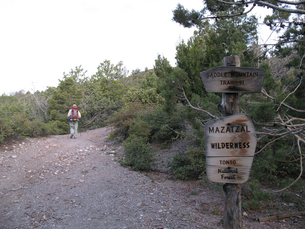
Passage 22 begins a long stretch through the Mazatzal Wilderness, which will continue through Passage 25. The Mazatzal Mountains are a diverse range defined by craggy peaks, serpentine canyons, and solitude.
The trail follows singletrack through thick manzanita and mountain shrubs. It features verdant hillsides, winding canyons, and craggy peaks. It passes by seeps and springs, and briefly follows Sycamore Creek.
The trail continues north through scrub oak and crosses a streambed in a charming valley under idyllic white cliffs. It skirts the side of Saddle Mountain, traversing through hillsides and rolling grasslands. It climbs up to Thicket Spring and continues along a rocky ascent to the junction with the Mazatzal Divide Trail (Trail 23) and the end of the passage.
Difficulty
- Moderate
Season(s)
All year. Snow can be present at higher elevations after winter storms and lower elevations can be quite warm in summer
Water
Water can often be found in creek 8.9 into passage at McFarland Canyon and Thicket Spring near end of passage. Check the online Arizona Trail Water Report for current information at https://aztrail.org/explore/water-sources/.
Notes/Warnings
- All water along this passage should be purified prior to use.
- Mountain bikes are prohibited in the Mazatzal Wilderness.
For more information
- The Passage Steward
- Tonto National Forest, Mesa Ranger District, 5140 E. Ingram St, Mesa, AZ 85205 (480) 610-3341.
- BLM Information Center (602) 417-9300.
