


In response to recent concerns about gastrointestinal illness along the Arizona Trail and potential causes being the Gila River and Remote Rainwater Collector, the ATA took water samples to a local laboratory for analysis. Results can be found here: Gila River - Passage 16 Rainwater Collector - Passage 17 The only alarming result is the presence of E. coli in the Gila River. This is no surprise, since cattle are found in abundance along the river. A recent survey also found a dead cow decomposing upstream of the location where most AZT travelers fill and filter bottles. These test results are a reminder that all water sources should be treated before drinking, especially when hiking or riding in cattle country. Testing water for the presence of norovirus was not possible, and is also extremely unlikely as norovirus is most commonly transmitted from person-to-person (according to epidemiology experts at the Arizona Department of Health Services). Studying the occurrence of norovirus on the AZT is ongoing, and results from the recent Sick Hiker Survey are anticipated in June 2025.
Read More
Location
- Tonto National Forest Boundary to Picketpost Trailhead
Length
- 11.6 miles
Southern Access Point: Tonto National Forest Boundary
- GPS Coordinates: 33.18106° N, 111.13717° W
- NOTE: This trailhead is not directly accessible by vehicles. See adjoining passages for access.
Access
The closest way to access the southern end of Passage 17 is to hike in from the Picketpost Trailhead (11.5 miles), or drive to the historic town of Cochran (follow Cochran Road south from the Florence-Kelvin Highway to the Gila River), cross the Gila River carefully, then hike north on the Arizona Trail for 9.3 miles. Forest Road 4 (Telegraph Canyon Road) is currently blocked south of the town of Superior due to mineral exploration activities. There is currently no way to access the Arizona Trail from this rugged jeep trail.
Northern Trailhead: Picketpost Trailhead
- GPS Coordinates: 33.27184° N, 111.17643° W
Access
From Florence Junction, drive east on US 60 for 9 miles. After mile marker 221, continue 0.5 miles and turn right (south) onto FR 231 (this point is 4 miles west of the town of Superior on US 60.) Drive 0.4 miles and turn left onto FR 310. Continue 0.6 miles, and then turn right at a sign for Picketpost Trailhead. You will see the large metal AZT sign marking the trailhead in 0.1 miles. There is no vehicle access to the Tonto National Forest boundary from here.
Trail Route Description
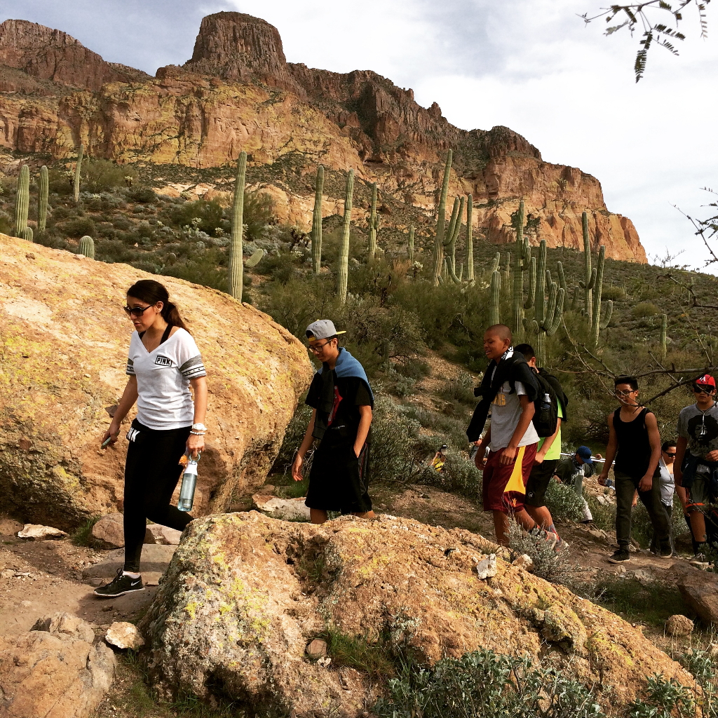
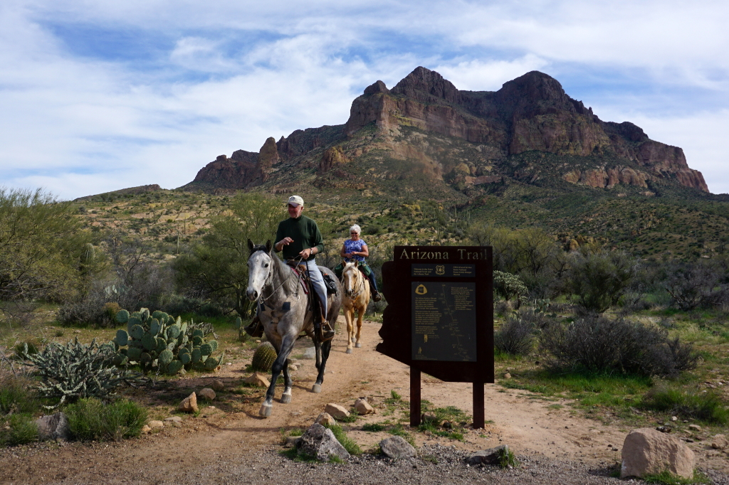
Passage 17 begins at the southern boundary of Tonto National Forest and continues north toward Picketpost Mountain. The trail follows a well-maintained singletrack through a classic Sonoran Desert landscape with towering saguaro, rugged mountains, and rocky canyons. Springtime brings an abundance of wildflowers to this region, and seeing Alamo Canyon in full bloom is breathtaking.
The trail weaves in and out of drainages and traverses across lush hillsides along a gentle downhill grade. Picketpost Mountain dominates the landscape in the northern half of this section, and catching it at sunset is a truly spectacular sight!
Difficulty
- Moderate
Season(s)
- Fall, Winter and Spring
- Current weather forecast
Water
There are no reliable water sources on this passage. Check the online Arizona Trail Water Report for current information at https://aztrail.org/explore/water-sources/.
Notes/Warnings
- All water along this passage should be purified prior to use.
- The Tonto National Forest is closing the gate at Picketpost TH between dusk and dawn now. There’s a site host there overnight so folks won’t get locked in, but no late night arrivals.
- There is no longer access to the Arizona Trail from Forest Road 4.
Resources
- MAP
- PROFILE
- TRACK
- Waypoints: GPS | MP
- Arizona Euro-American History
- USGS Topographic Maps: Teapot Mountain, Mineral Mountain and Picketpost Mountain.
- Tonto National Forest map.
For more information
- The Passage Steward
- Tonto National Forest, Globe Ranger District, 7680 S. Six Shooter Canyon Road, Globe, AZ 88501 (928) 402-6200.
Current Passage Info

Norovirus Advisory for Trail Users
April 11, 2025
Norovirus is a highly contagious virus that causes acute gastrointestinal illness and has recently affected hikers and bikers along certain sections of the Arizona National Scenic Trail (AZT), particularly around Kearny, Superior and Roosevelt. This advisory is intended to help trail users understand the risk and take proper precautions. What is Norovirus? Norovirus spreads easily through contaminated food, water, surfaces, or person-to-person contact. Symptoms typically include: Nausea Vomiting Diarrhea Stomach cramps Symptoms often appear 12–48 hours after exposure and can be intense but typically resolve within a few days. Preventive Measures for Trail Users Wash Hands with Soap and Water -- alcohol-based hand sanitizers are not effective against norovirus. Use soap and water, especially after using the bathroom and before eating. Practice Safe Food Handling Cook food thoroughly. Avoid sharing utensils, water bottles, or food with others. Maintain sanitation in the Backcountry Dig catholes 6–8 inches deep and at least 200 feet from water sources, campsites, and trails. Pack out trash and used toilet paper if possible. Treat Drinking Water Properly -- boil water or use chemical disinfectants. Standard filters may not remove norovirus. If You Get Sick Isolate yourself from other trail users to reduce the spread. Stay hydrated...
Read More

AZT Rainwater Collector
September 5, 2019
On August 30-31, a dedicated crew of eight Arizona Trail Association volunteers joined Assistant Trail Director Zach MacDonald to venture into a particularly remote segment of the Arizona Trail to install an AZT Rainwater Collector. This unit is the first of its kind and was designed by the Arizona Trail Association and metalsmith extraordinaire Rob Bauer in consultation with sustainability professionals, land managers and engineers. It features a steel apron that catches rainwater and stores the precious resource within a 1,500-gallon tank that is protected on all sides by steel panels. A spigot with an automatic shutoff valve allows trail users to fill and filter their bottles along this very dry and exposed segment of the Arizona Trail. Once the tank is full, an overflow pipe fills a steel water trough nearby for the benefit of wildlife. The entire unit is fenced to keep livestock out, and posted signs inform trail users that the water must be filtered before consumption. The AZT Rainwater Collector is located halfway between reliable water sources at the Gila River and a windmill near Picketpost Trailhead. This particular 21-mile segment has repeatedly proven to be daunting for many hikers, runners, and mountain bikers. Covering the...
Read More
