


thetrek.co~ MAY 20TH : GOOD ZEN Part 9: Oracle to Kearney: The Prometheus of Poo Much of the land after Oracle is a flat expanse between mountains. A good place for music, audiobooks, or conversation. The trail flew by for once, and with Mt. Lemmon a recent memory, Ice Cream and I were grateful to have some cruisy ground to hike on; it leaves plenty of breath for conversation, and we used all of it to dive deep into how our upbringing had affected our psychologies and our strategies for overcoming weaknesses we had inherited from our ancestors. And, as Forrest Gump says, That’s all I have to say about that. Read more
Read More
Location
- Tiger Mine Trailhead to Freeman Road Trailhead
Length
- 27.6 miles
Southern Trailhead: Tiger Mine Trailhead
- GPS Coordinates: 32.65044° N, 110.73150° W
Access
From the east entrance to the town of Oracle, drive 0.8 miles east on AZ 77 to mile marker 105 and turn left (north) onto Old Tiger Road. After 1.5 miles on this road, you’ll see an unmistakable Arizona Trail gateway on the left (north) side of the road. Parking is available on either side of the road.
Northern Trailhead: Freeman Road Trailhead
- GPS Coordinates: 32.87109° N, 110.88256° W
Access
From Mammoth, drive north on Hwy 77 to the town of Dudleyville. Turn left (west) on Dudleyville Road to the center of the community and locate San Pedro Road. Head west on San Pedro Road, where the road soon turns to dirt. Cross the San Pedro River * (usually dry or very shallow) and then turn north at intersection and follow road north along the river (Camino Rio) for 0.5 mile. Turn left (west) on Freeman Road. Cross railroad tracks and continue for 12 miles to the trailhead.
*San Pedro River can experience heavy flows during wet times of the year and may become impassable. Use caution and assess conditions before attempting to drive across the river. If this route is unsafe, you can approach from Freeman Road from Hwy 79 and/or Willow Springs Ranch Road from Hwy 77, which leads to Freeman Road.
Trail Route Description
Passage 14 meanders through the desert washes and arroyos of the Black Hills. This passage is characterized by ubiquitous cactus, sandy soil, and hot, dry weather, with springtime temperatures routinely topping 100 degrees! Extreme heat, lack of shade and unreliable water sources are the main challenges for visitors. Because of these challenges, the Black Hills are one of the least visited passages along the AZT.
Within this often overlooked, remote nature you will find outstanding opportunities for solitude, trail adventures, and relaxation under unobstructed desert skies.
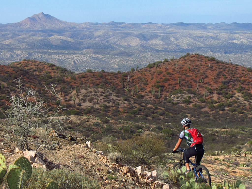
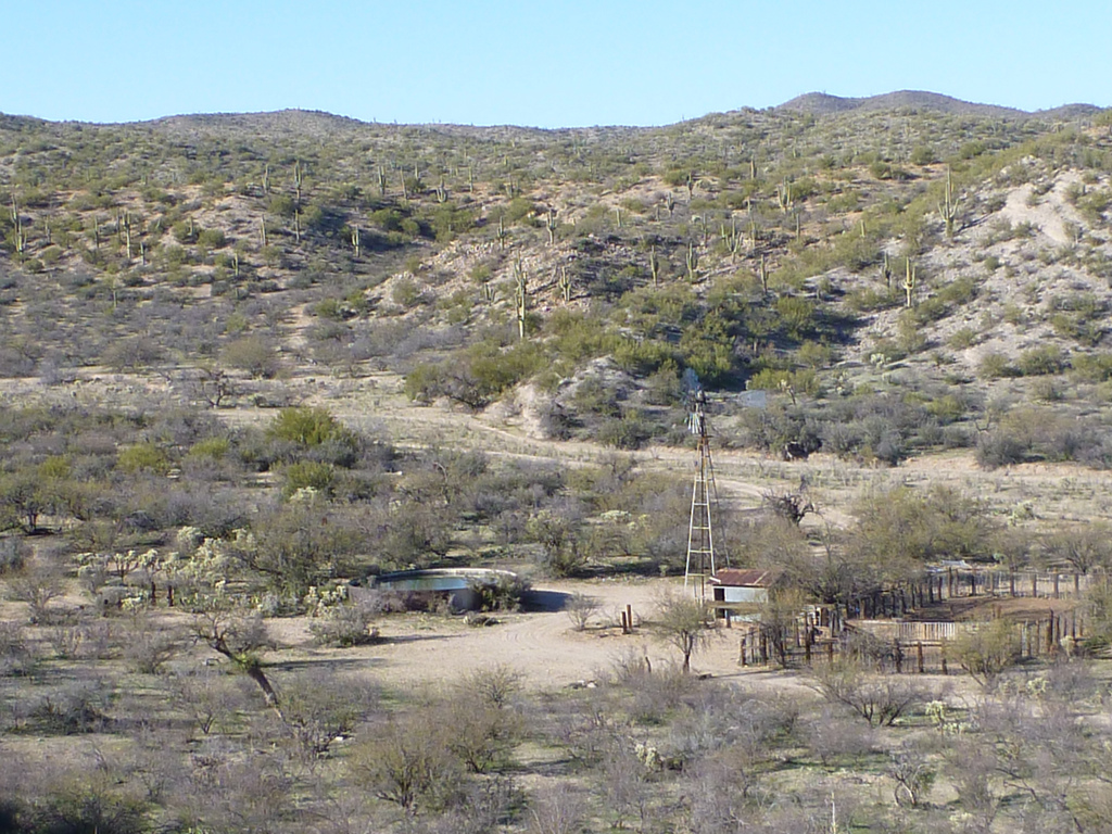
The trail follows both singletrack and doubletrack through a vast desert landscape, featuring the iconic saguaro cactus, prickly pear, and luminescent chollas, along with the quintessential desert sounds of the cactus wren. It crosses dirt roads, and passes by old cattle tanks, broken windmills, and abandoned wells.
The trail traverses many drainages and unique rock formations, and provides panoramic views as it climbs up and over the ridgeline of the Black Hills. Antelope Peak is a prominent landmark, as are the Superstition and Pinal Mountains. To the east lie the entire Galiuro Mountains and the San Pedro River. To the south are the Rincon and Santa Catalina Mountains. This vista illustrates just how expansive the Sonoran Desert is as it transitions from low to high desert.
Difficulty
- Moderate
Season(s)
- Fall, Winter and Spring
- Current weather forecast
Water
Water sources are very limited along this passage. Water can sometimes be found at Mountainview Tank, Cowhead Well and Beehive Well. Land owners have given consent for AZT users to use the man made water tanks and sources in this passage. However, this permission is provisional upon the continued good stewardship of these sources.
Notes/Warnings:
- All water along this passage should be purified prior to use.
- Although this passage crosses State Trust Land, a permit is not required as long as you are on or near the Arizona Trail.
Resources
- MAP
- PROFILE
- TRACK
- Waypoints: GPS | MP
- Arizona Euro-American History
- USGS Topographic Maps: Mammoth, North of Oracle, Putnam Wash and Black Mountain.
- BLM Information Center maps.
For more information
- The Passage Steward
- Arizona State Land Department, 1616 W. Adams St., Phoenix, AZ 85007 (602) 542-4631.
- BLM Information Center (602) 417-9300.
